Log in
All resources
Create a design
2,080 Free Images of Maps With Cartouches
bibliothèque nationale de france
cartouches by tomas lópez
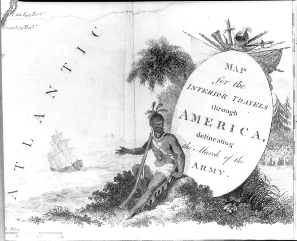
a map of the british empire in america with the french and spanish settlements adjacent thereto
maps in the library of congress
maps by nicolas sanson
maps by willem and johannes blaeu
maps by hendrik hondius the younger
maps from gallica
sanson maps of asia
old maps of the tyrol
david rumsey historical map collection
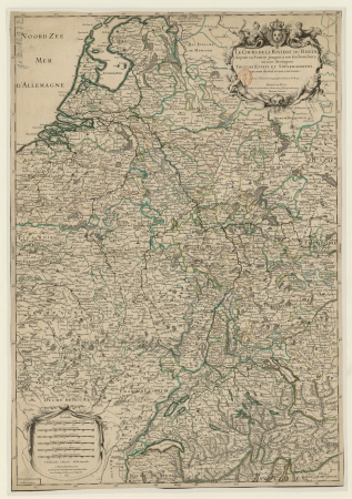
1790s maps of the holy roman empire
maps of paris from the david rumsey historical map collection
maps of paris by caspar merian
bibliothèque nationale de france
cartouches by tomas lópez
bibliothèque nationale de france
cartouches by tomas lópez
bibliothèque nationale de france
cartouches by tomas lópez
bibliothèque nationale de france
cartouches by tomas lópez
bibliothèque nationale de france
cartouches by tomas lópez
cartouche (cartography)
pierre mariette i
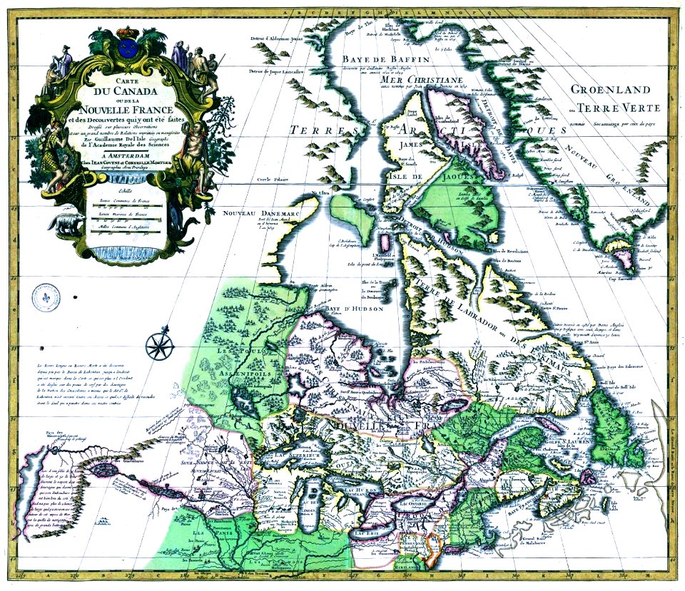
sanson maps of north america
maps by nicolas sanson
1810 maps of north america
1810 maps of mexico
maps of the peloponnese by gerardus mercator
1640s maps of greece
old maps of bourbonnais
1660s maps of france
maps by hendrik hondius the younger
1632 maps of africa
17th-century maps of savoie
old maps of savoie
maps of granada by braun & hogenberg
bibliothèque nationale de france
bibliothèque nationale de france
maps of goa by linschoten
bibliothèque nationale de france
cartouches by tomas lópez
1700s maps of the tsardom of russia
1700s maps of eastern europe
le royaume de france distingué by guillaume sanson
1724 maps of france
sanson maps of asia
1670s maps of asia
carte generale du tres-haut, tres-puissant et tres chrestien royaume de france
maps by nicolas sanson
maps of prague by braun & hogenberg
maps of cheb by braun & hogenberg
maps of the course of the rhine by guillaume sanson
robert cordier (engraver)
maps by alexis-hubert jaillot
old maps of the tyrol
historical
history
lawrence h. slaughter collection of english maps, charts, globes, books and atlases
covens en mortier
maps by guillaume sanson
old maps of friesland
laurent jean-françois truguet
cartouche (cartography)
map of the upper rhenian circle by sanson
1670s maps of hesse
sanson maps of the netherlands
1680s maps of the netherlands
map of the upper rhenian circle by sanson
1700s maps of north rhine-westphalia
historical
history
historical
history
18th-century maps of western europe
1754 maps of europe
map of the circle of austria by sanson
1700s maps of austria
maps of eschwege by braun & hogenberg
maps of fritzlar by braun & hogenberg
maps by nicolas sanson
sanson maps of asia
maps of alexandria by braun & hogenberg
bibliothèque nationale de france
maps of lyon by braun & hogenberg
bibliothèque nationale de france
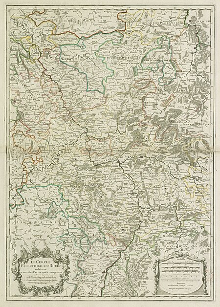
map of the circle of the rhineland by sanson
1730s maps of rhineland-palatinate
a map of the british empire in america with the french and spanish settlements adjacent thereto
maps in the library of congress
maps by nicolas sanson
sanson maps of asia
maps of freiberg by braun & hogenberg
bibliothèque nationale de france
maps of leeuwarden by braun & hogenberg
maps of franeker by braun & hogenberg
maps by hendrik hondius the younger
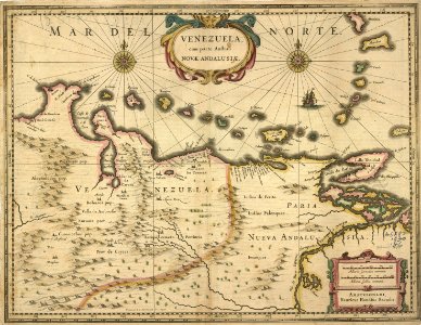
17th-century maps of south america
maps by nicolas sanson
sanson maps of asia
maps of brussels by braun & hogenberg
bibliothèque nationale de france
maps of deventer by braun & hogenberg
bibliothèque nationale de france
maps of county armagh
1760s maps of ireland
a map of the british empire in america with the french and spanish settlements adjacent thereto
maps in the library of congress
a map of the british empire in america with the french and spanish settlements adjacent thereto
maps in the library of congress
nouvel atlas de la chine
claas condet
maps by willem and johannes blaeu
1630s maps of the caucasus
maps in the rijksmuseum amsterdam
old maps of tholen
bibliothèque nationale de france
cartouches by tomas lópez
mapa del principado de cataluña (1776)
cartouches by tomas lópez
bibliothèque nationale de france
cartouches by tomas lópez
bibliothèque nationale de france
cartouches by tomas lópez
sanson map of the german empire (17th century)
sanson maps of the circles of germany
bibliothèque nationale de france
cartouches by tomas lópez
pieter verbiest (ii)
maps from gallica
sanson map of the german empire (17th century)
sanson maps of the circles of germany
sanson map of the german empire (17th century)
sanson maps of the circles of germany
bibliothèque nationale de france
cartouches by tomas lópez
maps in the library of congress
1718 maps of north america
sanson map of the german empire (17th century)
sanson maps of the circles of germany
old maps of the tyrol
south tyrol
old maps of the tyrol
south tyrol
a map of the british empire in america with the french and spanish settlements adjacent thereto
maps in the library of congress
a map of the british empire in america with the french and spanish settlements adjacent thereto
maps in the library of congress
old maps of the tyrol
south tyrol
bibliothèque nationale de france
cartouches by tomas lópez
volhynian voivodeship (1569–1795)
maps of volhynia
sanson maps of the netherlands
robert cordier (engraver)
cartouches by willem and johannes blaeu
maps made in the 17th century
carte des pays-bas catholiques by guillaume sanson
maps by alexis-hubert jaillot
old maps of norway
guillaume sanson
old maps of plymouth and devonport
16th-century maps of england
1730s maps of the philippines
baroque painting
biblioteca di storia e cultura del piemonte "giuseppe grosso"
maps of italy
maps of the malay archipelago by mercator-hondius
old maps of france
old maps of lyon
17th-century maps of tartary
17th-century maps of siberia
maps in the library of congress
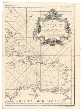
cartes et plans de l'amerique
le royaume de france distingué by guillaume sanson
1724 maps of france
pieter verbiest (ii)
maps from gallica
map of the circle of lower saxony by sanson
bibliothèque nationale de france
maps of paris by braun & hogenberg
bibliothèque nationale de france
bibliothèque nationale de france
cartouches by tomas lópez
18th-century maps of gibraltar
maps by tomas lopez
maps of italy by sanson and cordier
bibliothèque nationale de france
1670s maps of greece
guillaume sanson
map of italy by guillaume delisle (1700)
bibliothèque nationale de france
mappe-monde geo-hydrographique (sanson and jaillot, 1674)
bibliothèque nationale de france
a map of the british empire in america with the french and spanish settlements adjacent thereto
1730s maps of the caribbean
a map of the british empire in america with the french and spanish settlements adjacent thereto
1730s maps of the caribbean
a map of the british empire in america with the french and spanish settlements adjacent thereto
1730s maps of central america
maps by johann baptist homann
sanson maps of the holy land
juan de la cruz cano y olmedilla
1750s maps of the caribbean
1760 maps of asia
baroque painting
801 - 900 of 2,080
Next page
/ 21


![Duchy of Bourbonnois / [Pierre Mariette], Pierre Mariette I, 1668](https://cdn.creazilla.com/illustrations/10000907076/duchy-of-bourbonnois-pierre-mariette-pierre-mariette-i-1668-sm.webp)